


Places and Plaques
Wenonah Historical Society – House Plaque Program
The Wenonah Historical Society (WHS) started its House Plaque Program in 1987 as a way to promote the history of the borough. The program was guided through its first 7 years by Jean and Jack Ehlers and culminated with the publication of the “Wenonah House Register” in 1994. The register contained narratives of the history of more than 70 houses and other historic structures. The program continued under the leadership of Frank Eggert, who further memorialized the history of Wenonah by compiling deed searches and photographs for each of the 168 houses with plaques in the borough at that time.
The Wenonah Historical Society has now provided plaques for more than 200 houses and buildings. The locations of these structures, along with the name of the original owner and approximate year of construction, can be viewed on the interactive map on this website.
The WHS House Plaque Program remains quite active. All houses in the borough that are at least 90 years old are eligible for a plaque. If you are interested in purchasing a plaque for your home or have any questions about the program, please contact Larry Smith at larrysmith01@comcast.net. The cost is $75 and includes all necessary research of deeds, maps, census information, and WHS archives.
The WHS would like to see every eligible house in Wenonah with a plaque!

Interactive Map of Wenonah Structures from 1763-1930
Click on the time period that you would like to view -- or on the individual icons to see data for each structure including address and original owner(s). As of April 2024 we have 194 structures listed for this time period.
Read an article in the November, 2011, WHS Newsletter about the process used by Frank Eggert to document these homes. You will have to scroll down to page 3 of the newsletter.
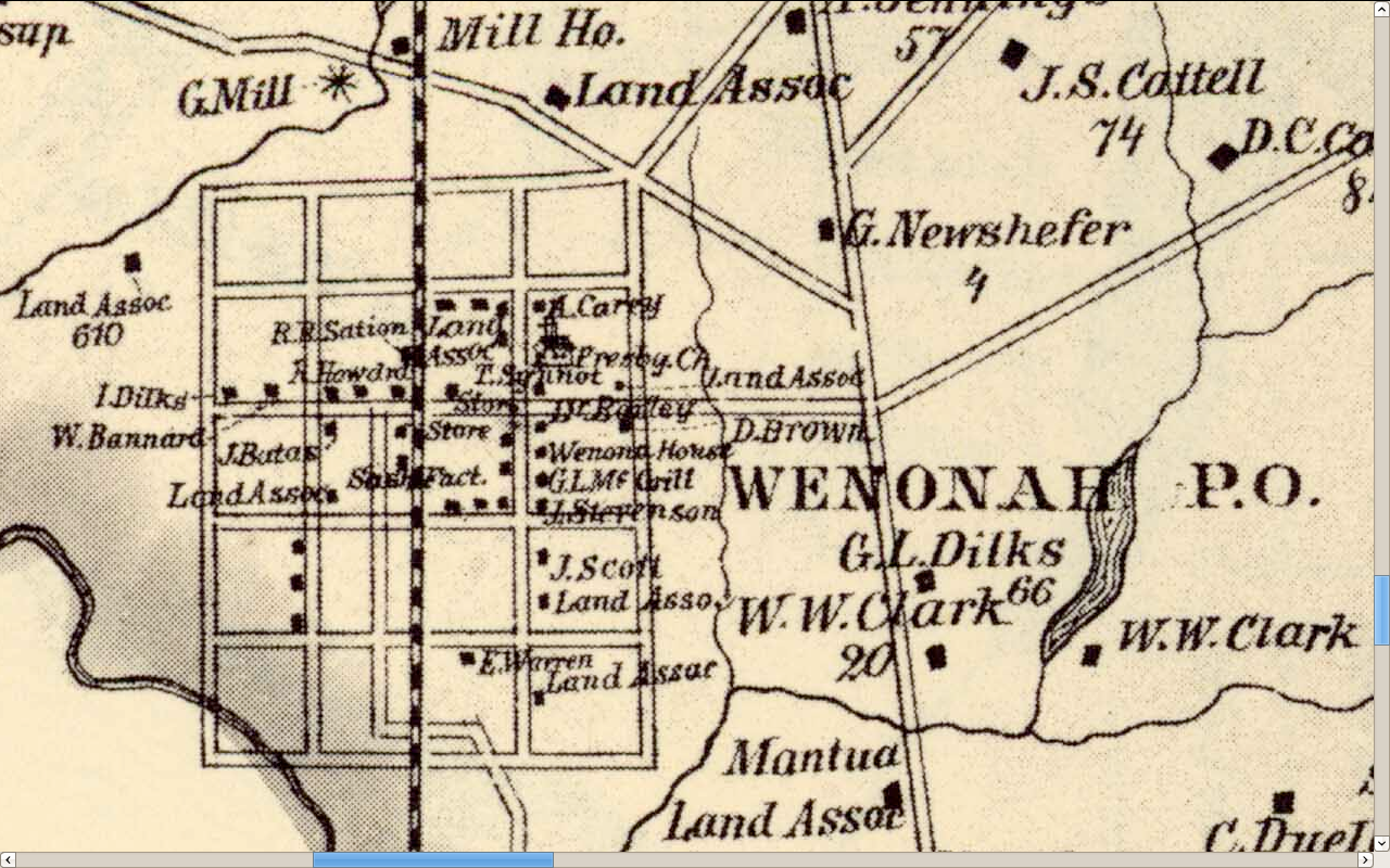
1869 Lake and Beers Map of Philadelphia and vicinity.
The map includes parts of Gloucester, Camden and other counties. In 1869 Wenonah was not on the maps as such. You can find the site of present day Wenonah by following the railroad south from Woodbury to where it crosses the Mantua Creek. There is a lake with a grist mill near a Dilk's home -- that lake and mill was once called Dilk's Mill then Warner's Lake and now Wenonah Lake. The railroad ran down what is now Jefferson Ave and along the top of Clay Hill across the Mantua Creek. Mantua is shown as Carpenter's Landing, Woodbury Heights, Sewell, and Pitman have not been created yet. Toll houses are marked as many roads were toll roads.
You can zoom in. Enjoy!
https://www.davidrumsey.com/ll/detailView.html?&manifestUrl=https%3A%2F%...
Another source for the 1869 Lake and Beers map is at the West Jersey History Project.
http://www.westjerseyhistory.org/maps/Lake%20and%20Beers-Philadelphia%20...
Click on Deptford map to see Wenonah
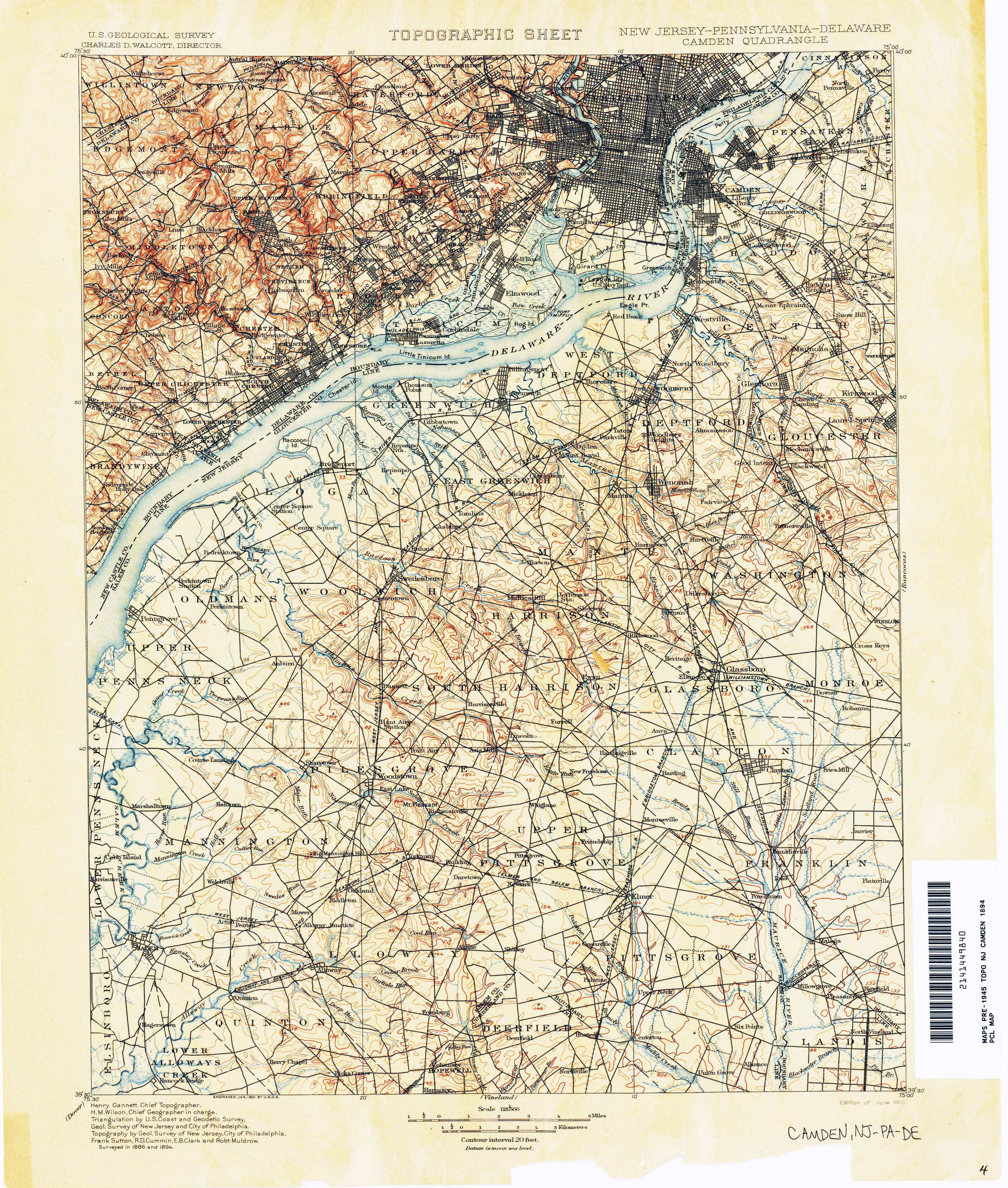
1894 Topo Map of Camden and vicinity, Wenonah is included
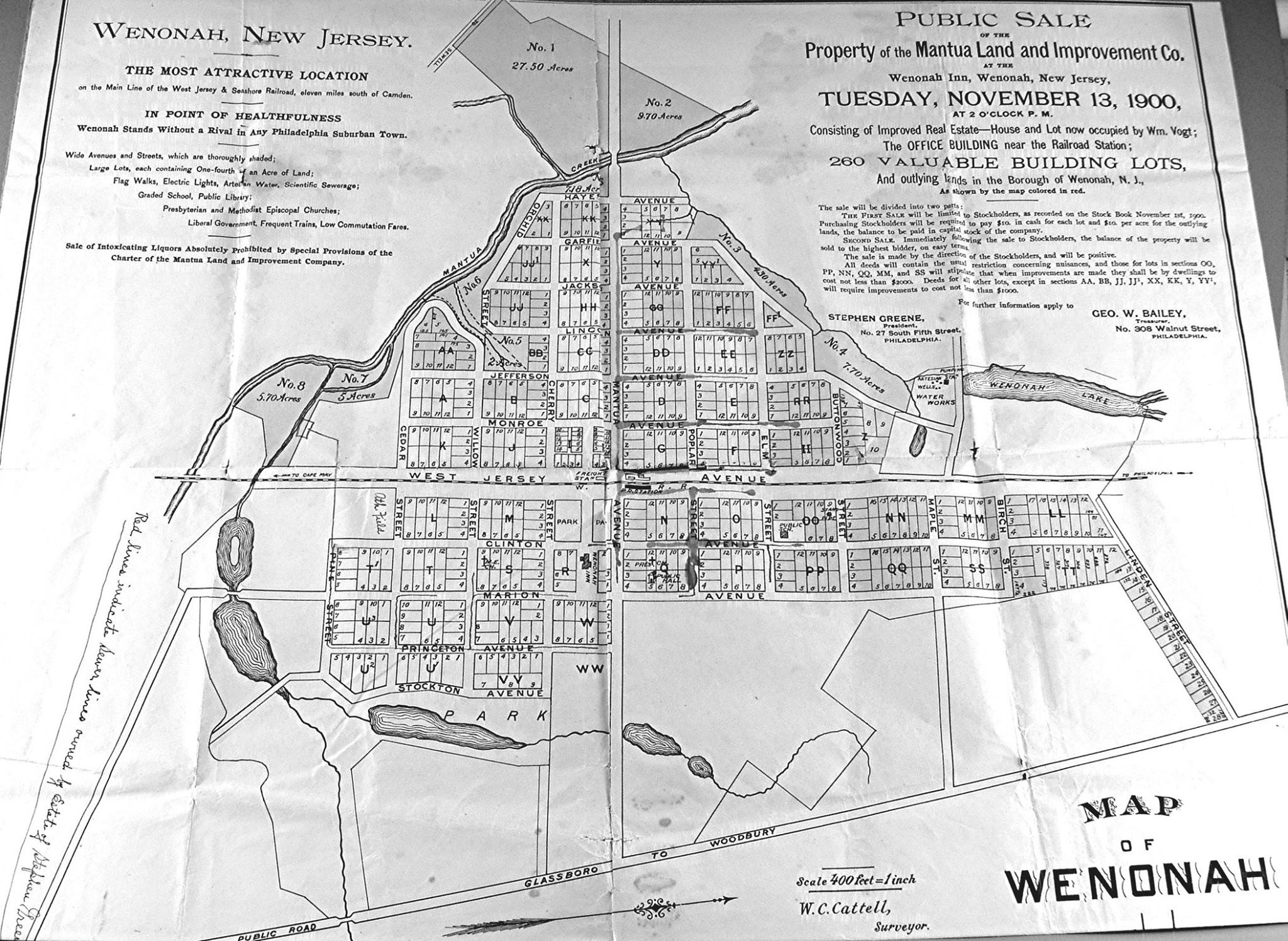
1900 Land Sale Map -- North is at right side of map.
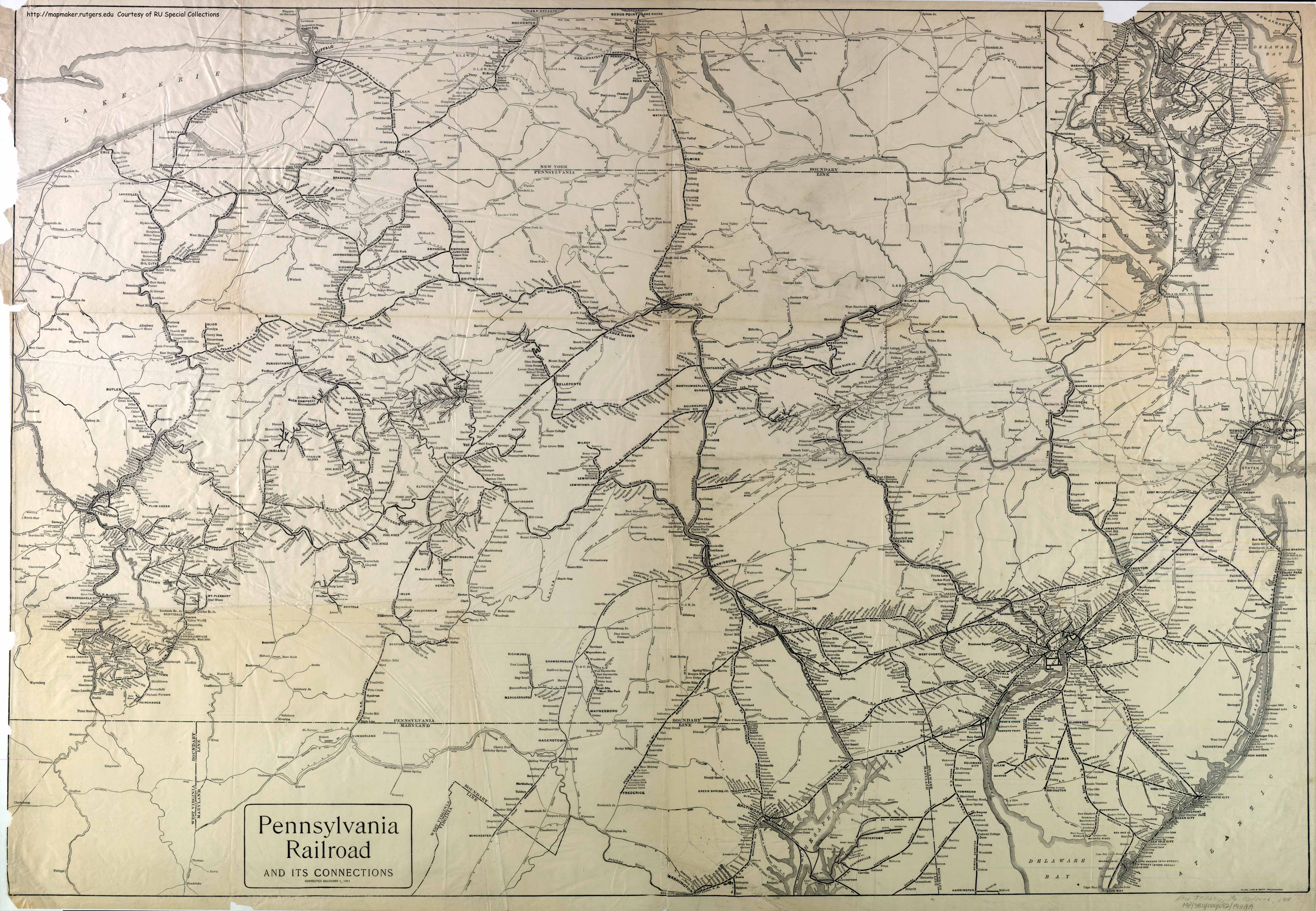
1911 Map of Railroads and Ferries
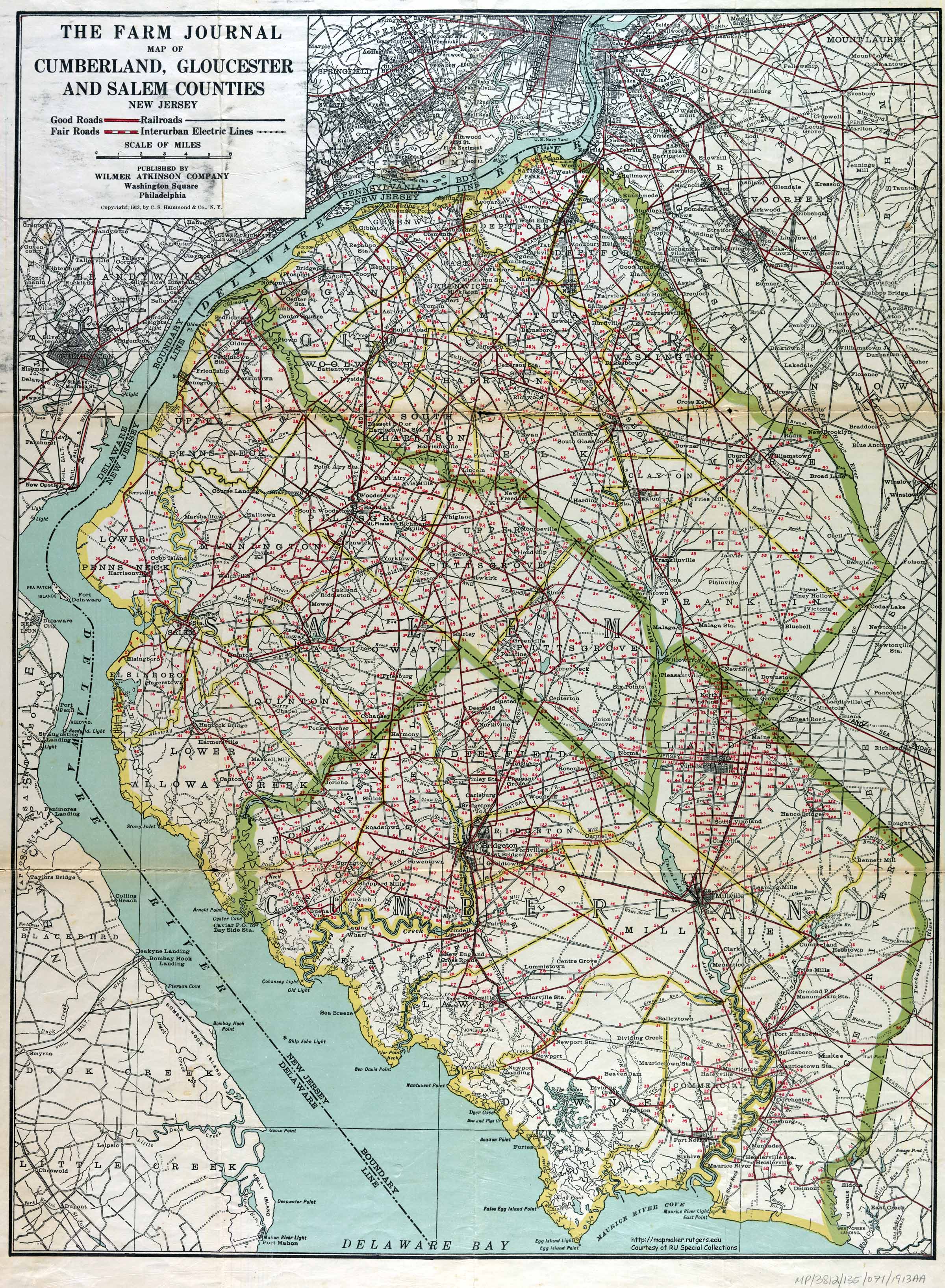
1913 Map of Gloucester, Salem and Cumberland Counties - show trolley lines.
1951 Aerial Photograph of Wenonah and vicinity
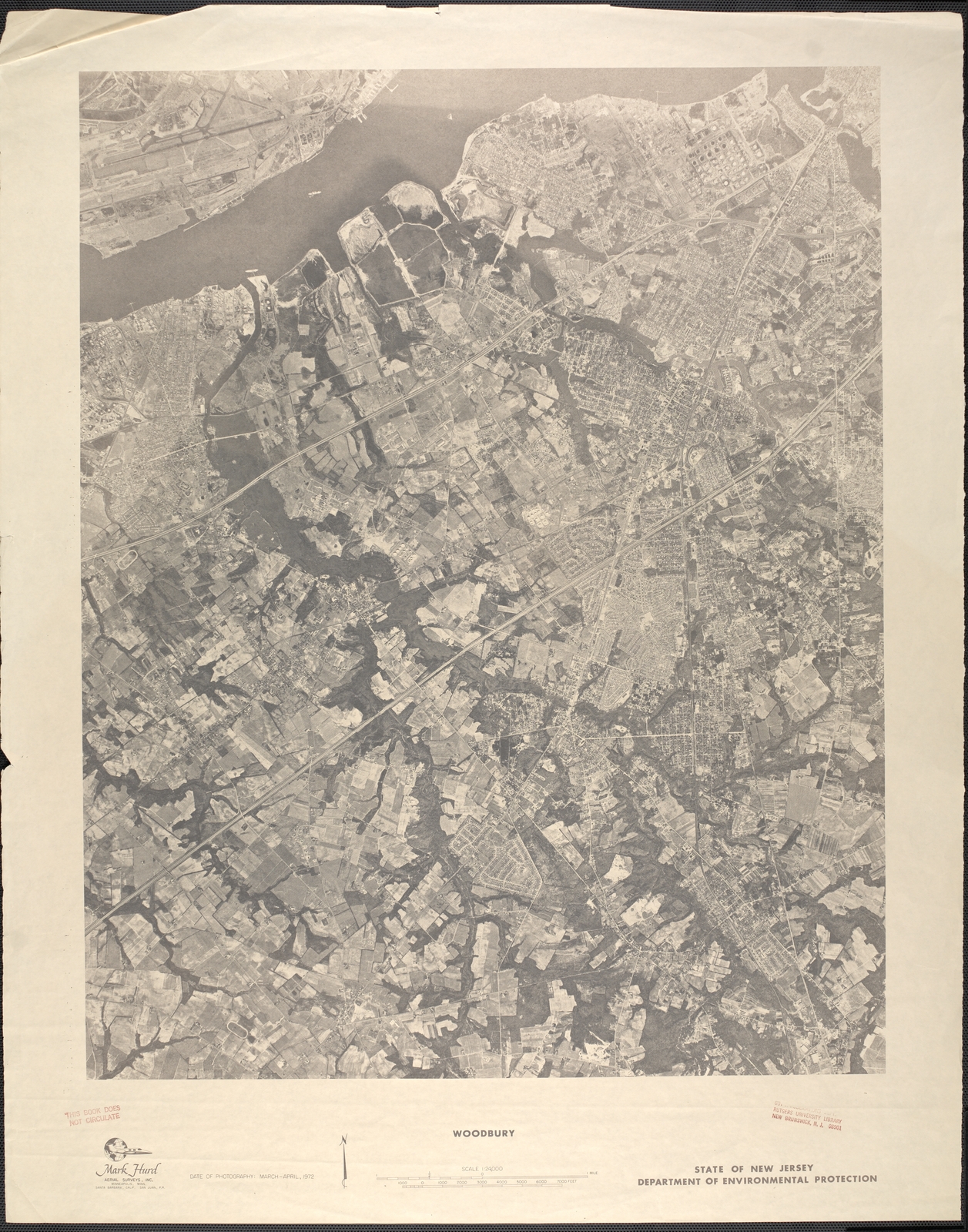
1972 Aerial photo of Wenonah and vicinity
A map of the various parts of this site.
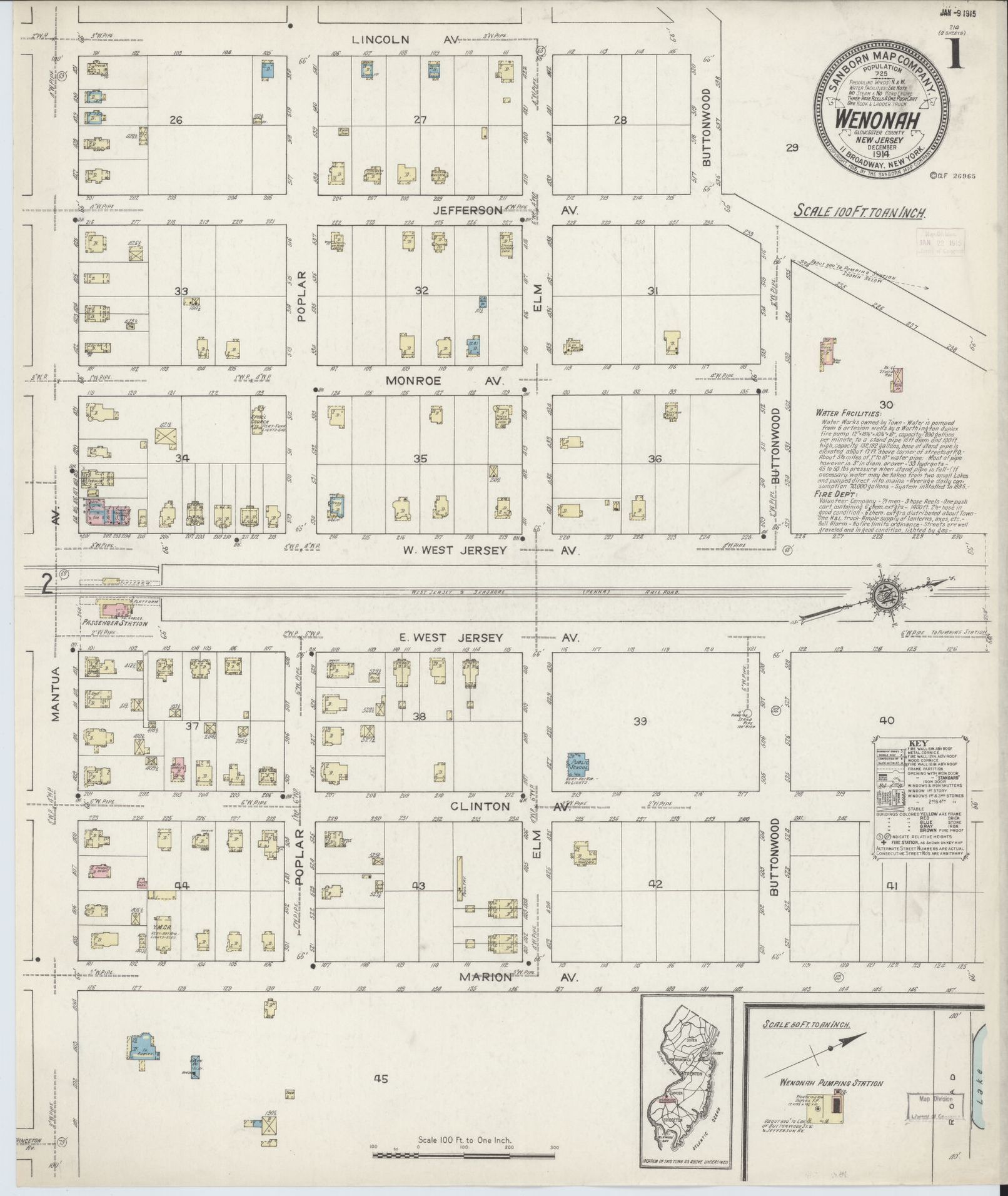
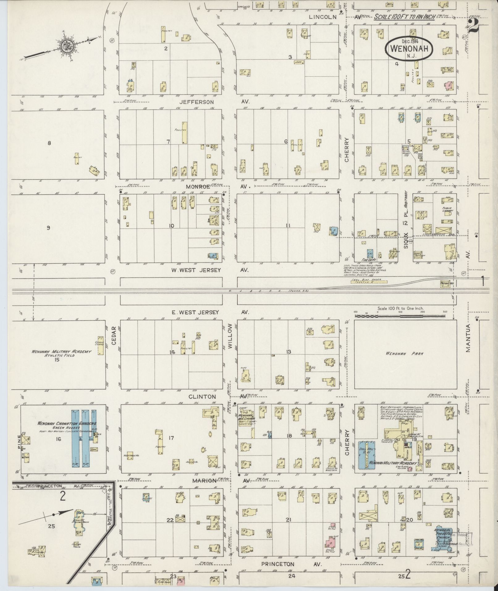
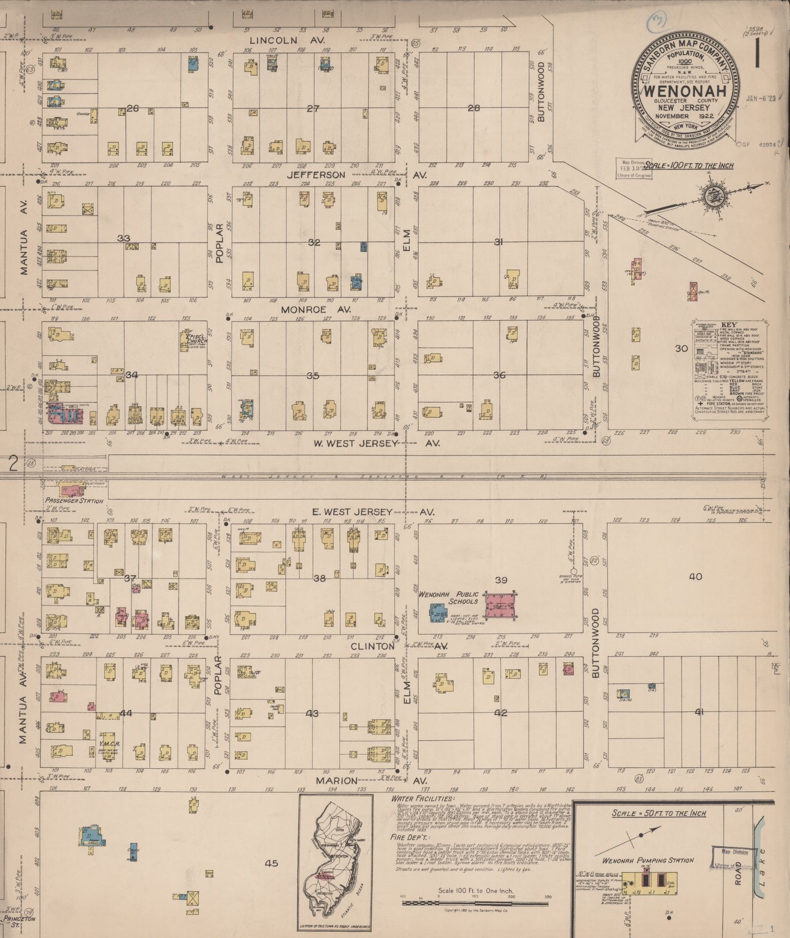
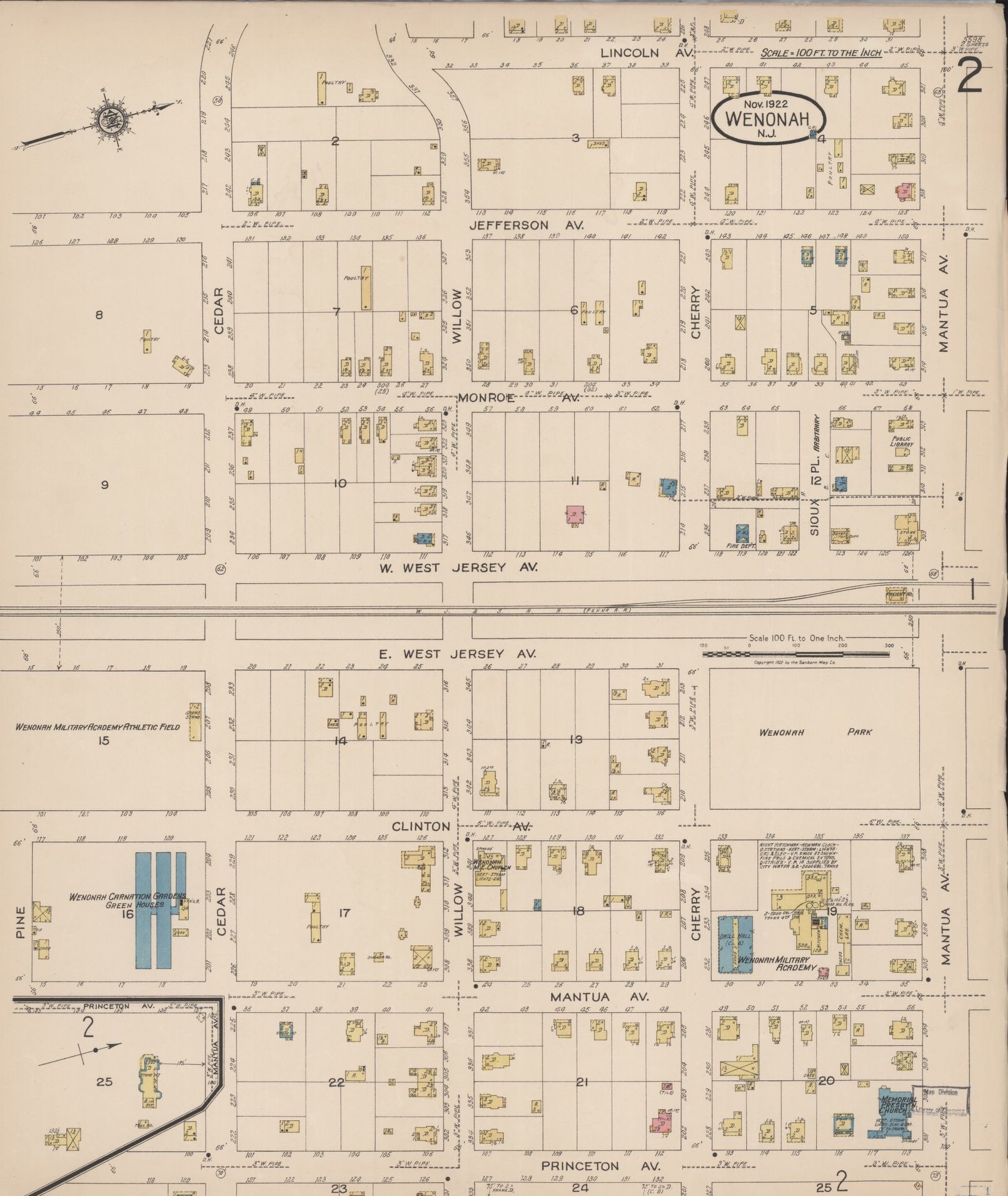
Sanborn Map Company Insurance Maps in links below.